Advanced Drone Operations
Transport Canada Advanced-certified RPAS missions across forestry, mining, construction, and infrastructure. Mapping-grade deliverables, documented compliance, and the paper trail your project needs.
What You Get
Every engagement includes:
View your mapping data on the web through the Maple Response client portal — explore, measure, and share your maps from any browser.
Full-resolution imagery and processing outputs are yours to keep, delivered in the formats agreed in the pre-flight site assessment.
Every mission is flown by Transport Canada Advanced-certified pilots, with the compliance documentation your project needs.
Orthomosaic Maps
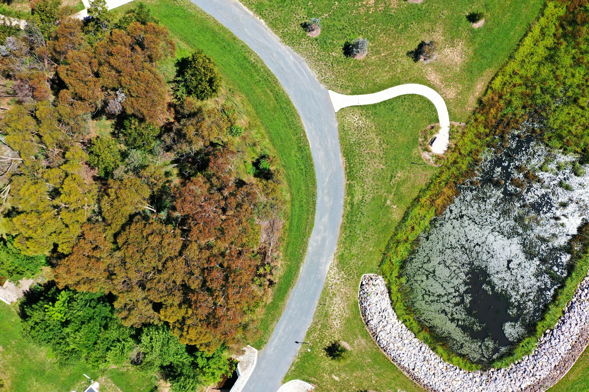
High-resolution, geo-referenced aerial maps stitched from hundreds of overlapping images. Every 2D map comes with an interactive online viewer to explore and share with your team. Plus the raw data for use in any GIS platform.

RGB, Thermal & Multispectral Imaging
Visible, infrared, and multispectral sensor packages matched to the mission. Used for visual documentation, heat-loss and equipment anomaly detection, and vegetation health assessment.
Digital Surface & Elevation Models
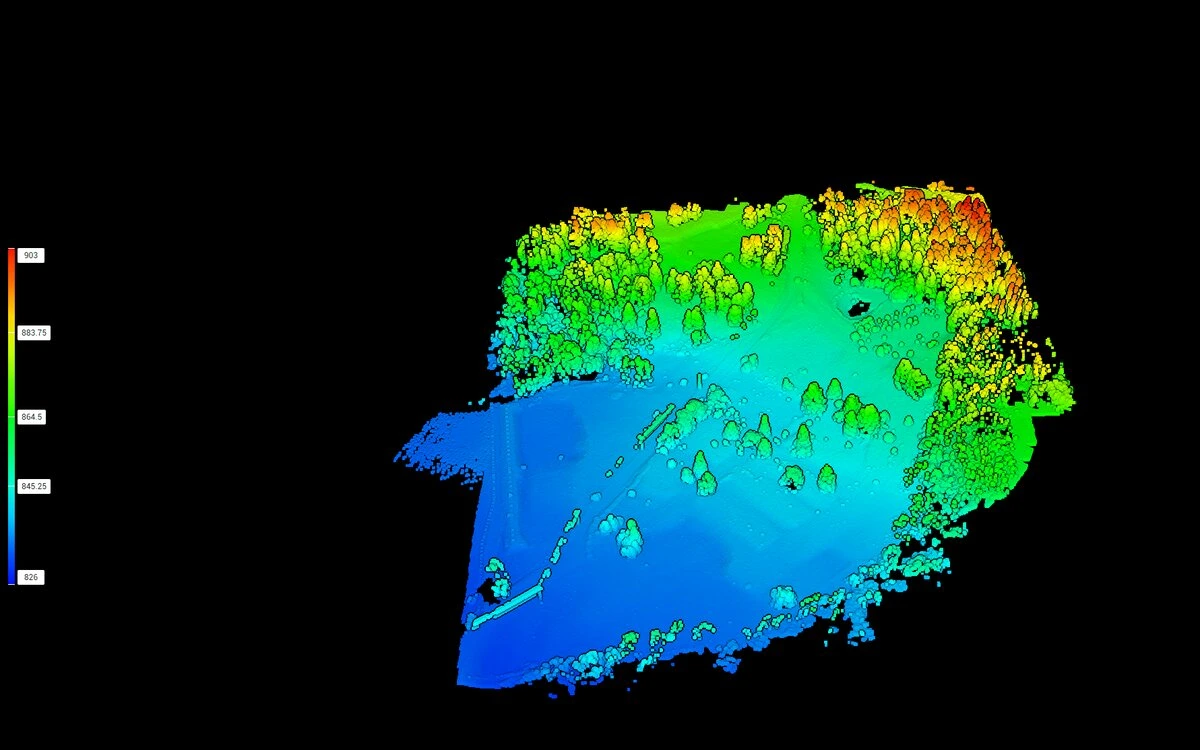
DSM and DEM elevation data captured with RTK precision. Supports volumetric calculations, grading plans, drainage analysis, and site progress tracking against design files.
3D Site Models
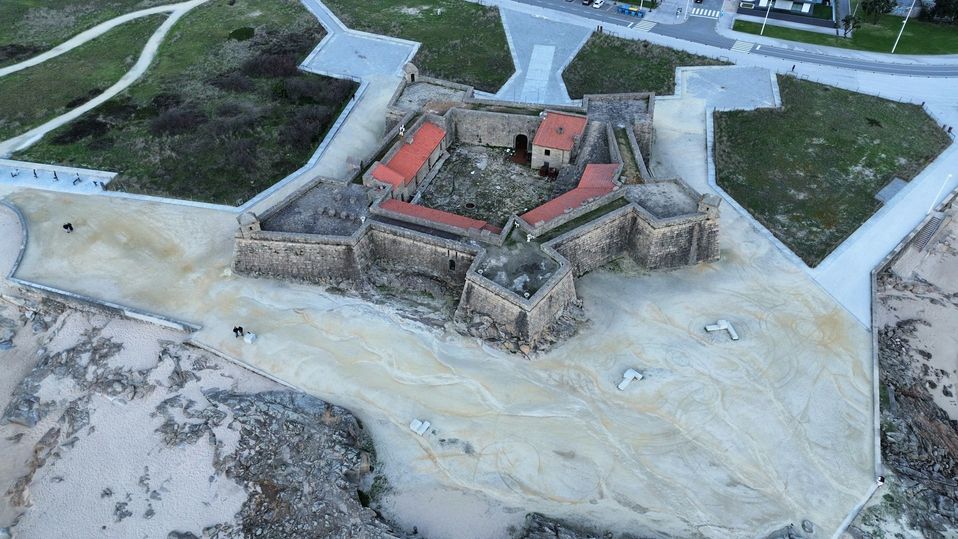
Photogrammetric 3D reconstructions of structures, terrain, and infrastructure. Used for stakeholder visualization, dimensional measurement, and as-built comparison.

Construction Progress Documentation
Scheduled aerial captures across the project lifecycle, flown to the same paths and angles each visit. Produces side-by-side comparisons that show progress against schedule and budget.

Infrastructure Inspections
Visual aerial inspection photography of roofs, façades, towers, bridges, and other structures. Captured with zoom and thermal payloads where the site permits.
Your Data, Live In Your Browser
Every mapping mission we fly is delivered through the Maple Response client portal. Log in to see every map prepared for you, open them in the interactive viewer, and request your next flight — all in one place.

Your data sits behind your own sign-in — shared with your team, not the world.
Client Portal

Every map we've prepared for you, with its available views at a glance.


Switch views, measure distances and areas, and mark up the map with pins and notes.

Outline your site on the map, pick your deliverables, and submit — we'll take it from there.
- Log in to a dashboard of every map we've prepared for you
- Switch views — true-colour photo, elevation, and crop health where flown
- Measure distances and areas, and mark up the map with pins, warnings, and notes
- Request new flights and track them from the portal — no phone call needed
Working With Your Team
Our deliverables are designed to support, not replace, your licensed professionals. We're happy to talk through the right scope for your project.
WHAT WE DELIVER
- High-resolution, geo-referenced aerial imagery captured by Transport Canada Advanced pilots
- Repeatable documentation of site conditions across the project lifecycle
- An Aerial Mapping Report and raw data files you can hand to your engineer, planner, or insurer
HAND-OFF POINTS
- A BC Land Surveyor produces the stamped legal survey; our data supports their work
- A qualified engineer interprets structural or geotechnical findings; our imagery documents what's visible
Let's Plan Your Mission
Tell us about the site, the deliverable you need, and the timeline. We'll come back with a proposal, a price, and a date.
Request a QuoteAdvanced Drone Operations
Transport Canada Advanced-certified RPAS missions across forestry, mining, construction, and infrastructure. Mapping-grade deliverables, documented compliance, and the paper trail your project needs.
What You Get
Every engagement includes:
View your mapping data on the web through the Maple Response client portal — explore, measure, and share your maps from any browser.
Full-resolution imagery and processing outputs are yours to keep, delivered in the formats agreed in the pre-flight site assessment.
Every mission is flown by Transport Canada Advanced-certified pilots, with the compliance documentation your project needs.
Orthomosaic Maps
High-resolution, geo-referenced aerial maps stitched from hundreds of overlapping images. Every 2D map comes with an interactive online viewer to explore and share with your team. Plus the raw data for use in any GIS platform.
RGB, Thermal & Multispectral Imaging
Visible, infrared, and multispectral sensor packages matched to the mission. Used for visual documentation, heat-loss and equipment anomaly detection, and vegetation health assessment.
Digital Surface & Elevation Models
DSM and DEM elevation data captured with RTK precision. Supports volumetric calculations, grading plans, drainage analysis, and site progress tracking against design files.
3D Site Models
Photogrammetric 3D reconstructions of structures, terrain, and infrastructure. Used for stakeholder visualization, dimensional measurement, and as-built comparison.
Construction Progress Documentation
Scheduled aerial captures across the project lifecycle, flown to the same paths and angles each visit. Produces side-by-side comparisons that show progress against schedule and budget.
Infrastructure Inspections
Visual aerial inspection photography of roofs, façades, towers, bridges, and other structures. Captured with zoom and thermal payloads where the site permits.
Your Data, Live In Your Browser
Every mapping mission we fly is delivered through the Maple Response client portal. Log in to see every map prepared for you, open them in the interactive viewer, and request your next flight — all in one place.
Your data sits behind your own sign-in — shared with your team, not the world.
Client Portal
Every map we've prepared for you, with its available views at a glance.
Switch views, measure distances and areas, and mark up the map with pins and notes.
Outline your site on the map, pick your deliverables, and submit — we'll take it from there.
- Log in to a dashboard of every map we've prepared for you
- Switch views — true-colour photo, elevation, and crop health where flown
- Measure distances and areas, and mark up the map with pins, warnings, and notes
- Request new flights and track them from the portal — no phone call needed
Working With Your Team
Our deliverables are designed to support, not replace, your licensed professionals. We're happy to talk through the right scope for your project.
WHAT WE DELIVER
- High-resolution, geo-referenced aerial imagery captured by Transport Canada Advanced pilots
- Repeatable documentation of site conditions across the project lifecycle
- An Aerial Mapping Report and raw data files you can hand to your engineer, planner, or insurer
HAND-OFF POINTS
- A BC Land Surveyor produces the stamped legal survey; our data supports their work
- A qualified engineer interprets structural or geotechnical findings; our imagery documents what's visible
Let's Plan Your Mission
Tell us about the site, the deliverable you need, and the timeline. We'll come back with a proposal, a price, and a date.
Request a Quote